
I had seen the news reports covering the severe beach erosion along certain parts of the Cape so we drove up to Nauset Beach to check it out. Nauset Beach is part of the Cape Cod National Seashore. It's mostly a sightseeing beach for use due to the heavy surf and frequent (great white) shark sightings. The water is usually frigid as well. It's a beautiful beach though.
See!
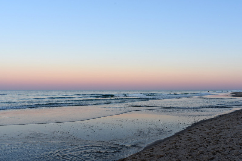
(From last summer)
There is (was) a snack shack, Liam's, located at the main entrance to the beach. We ate dinner there a few years ago and despite rave reviews online, we did not enjoy our food. We're thinking that they just had an off night. This past summer, we did order french fries for a snack one afternoon and they were tasty. Liam's is (was) known for their onion rings, which unfortunately we never tried. Rich can't eat onions so it's not something we typically order.
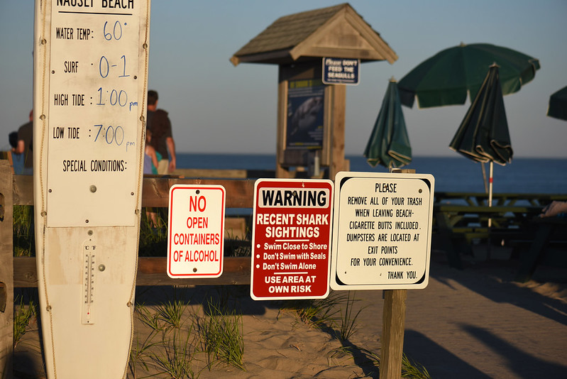
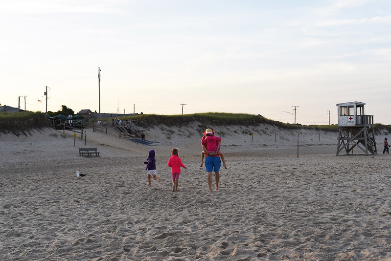
During the summer months, there are tables located across from the ordering windows at Liam's and then behind Liam's in the sand. The dune sloped down to the beach after those tables. The following photos are from summertime. I want to show you what it used to look like.
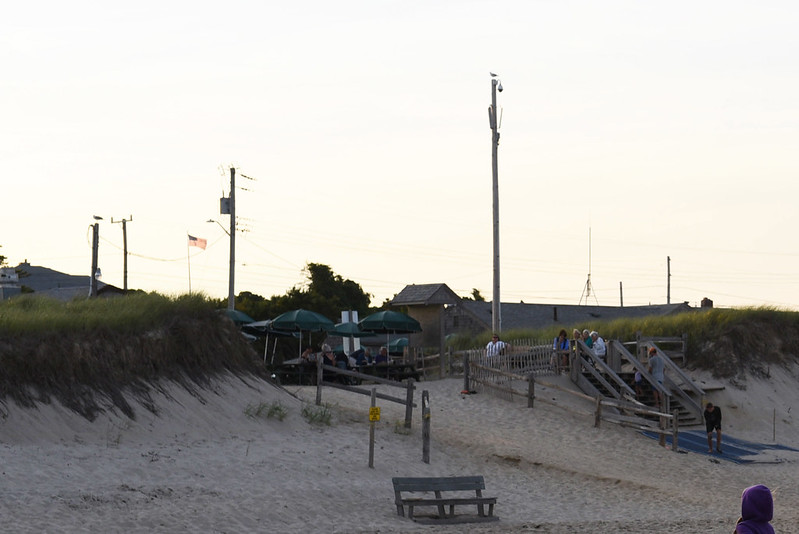
Liam's is located to the right and a little bit back of this row of signs. To the left you can see the tables and chairs and then the shark warning sign before you descend to the beach.
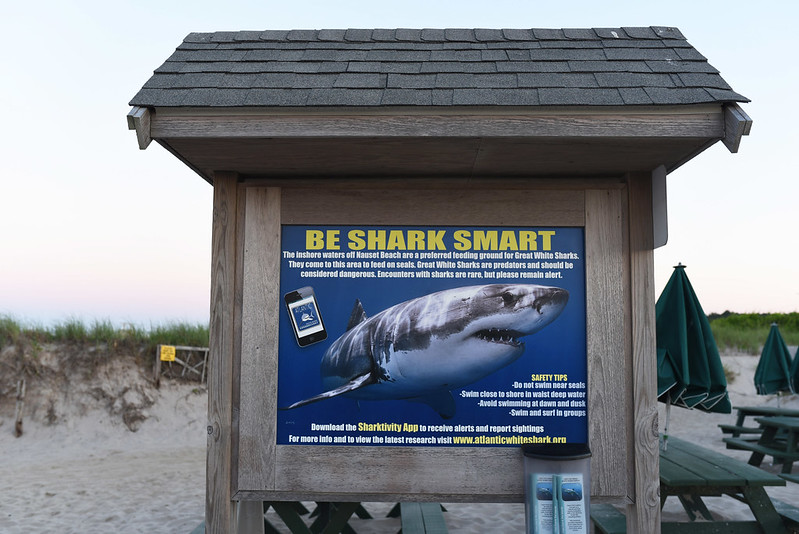
Here's the shark warning sign you can see in the background of the above photo. Liam's is to the right after a bunch of tables.
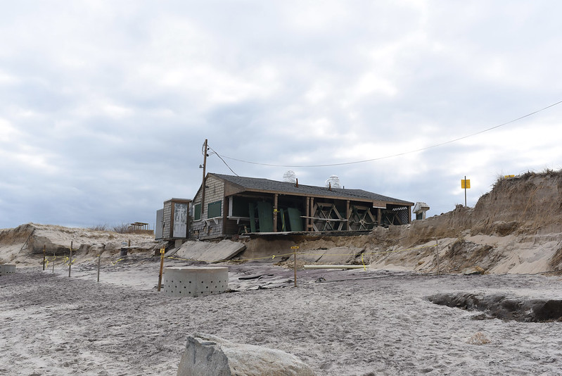
This is what Liam's looks like now after these recent storms.
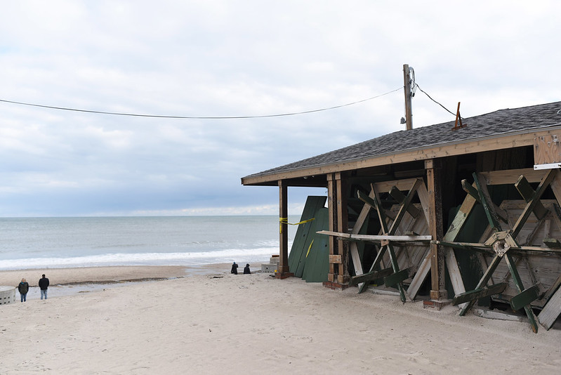
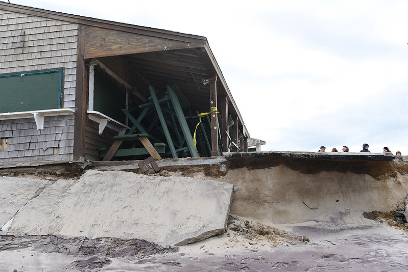
All of those signs, the sandy area for tables and the dune leading down to the beach are gone.
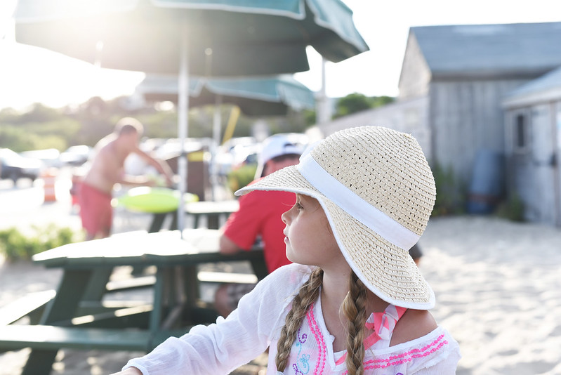
In this photo from a few years ago, Emily is sitting at a table across from the ordering windows at Liam's. The building in the background is an admin office along with bathrooms.
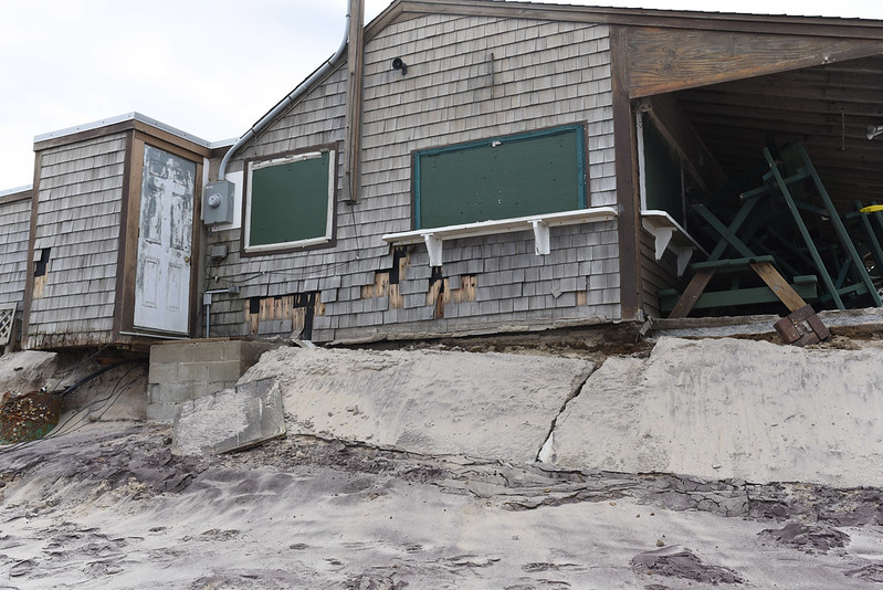
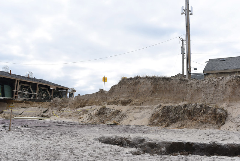
Here's the admin building now.
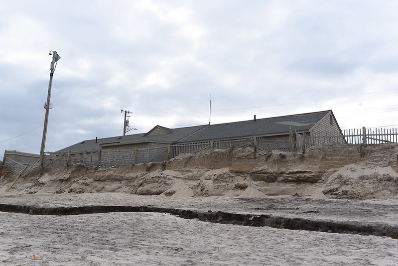
The dunes separating it from the beach are almost completely gone.
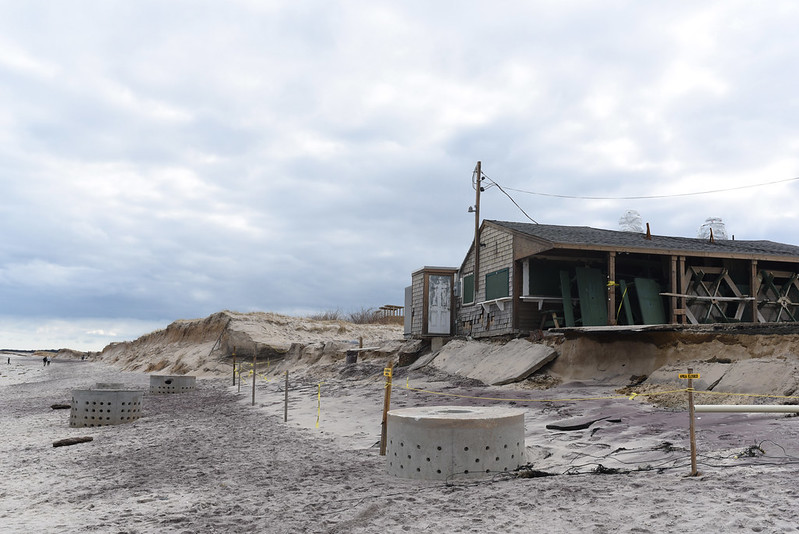
This next photo is technically a fail but I'm including it because it's a wide view of the area.
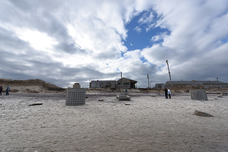
Before the storms, those cement towers had all been under the sand. I'm not sure exactly what they are but one news article I read indicated that they were remnants from a septic system.
Here's a photo I took a few years ago showing the same area, just from a slightly different angle.
This is just a crop of the above photo. The roof on the left belongs to Liam's.
The building that houses Liam's was originally built in the mid-1950s as a clam shack. The current owner took over and named it Liam's in 1990. On Monday, the selectman in conjunction with park commissioners voted to end their lease with the owner of Liam's and the building will be torn down. Everyone keeps commenting on the sadness of the situation and while I agree that it's sad, it's also terrifying to see the destruction caused by a handful of powerful storms over two months' time. These storms were labeled nor'easters and bomb cyclones. Or nor'easters with bomb cyclones. What could a major hurricane wipe out?
No comments:
Post a Comment